Home Industry Environmental sustainability Unforeseen Earthquake Strikes ...
Environmental Sustainability
CIO Bulletin
12 February, 2025
On the night of Saturday, the Honduras Islands in the Caribbean Sea were struck by a strong earthquake strike of 7.6 magnitudes, sending after-quake waves across the region to be alerted for tsunami and the safety concerns for the nearby places of Puerto Rico, the U.S. Virgin Islands, and the Cayman Islands. Luckily, there were minor shifts in sea levels due to the intensity of the earthquake, and the tsunami advisory was shelved. Powerful Earthquake Strikes the Western Caribbean, Shaking Coastal Regions.
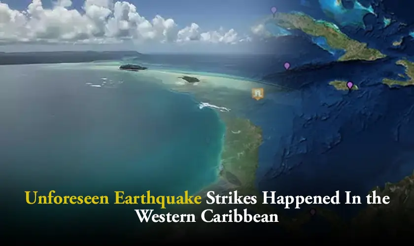
The earthquake hit at 06:23 P.M. ET, being about 130 miles far from the epicenter and located south-southwest of the George Town region, Cayman Islands. The U.S. Geological Survey stated that the tremor was in the range of about 6 miles below the surface with the shockwaves disseminating through the near regions. The Cayman Islands were initially affected by a tsunami warning, but the warning was withdrawn shortly afterward. There were no major damages reported, thus provoking critical questions relating to the hazards posed by earthquakes in this area and their ability to induce tsunamis.
The western Caribbean has not been without incidents concerning earthquake strikes; it has engaged itself fully in its historical adventures and this region is located along North America and Caribbean tectonic plates’ boundaries. Seismically, the area is highly susceptible to occurrences of earthquakes. The Cayman Trough, the fault associated with this region lying close to the Cayman Islands, is the principal cause of earthquakes that seem frequent in the region. Earthquakes of this area usually occur in association with strike-slip faults; meaning, that plates shift horizontally past each other. The seismic setting explains why large earthquakes are not uncommon; it can be noted from the earthquake strike of 7.5 magnitudes that happened in the region in 2018 producing a small tsunami.
Several earthquake strikes occur in the area; however, tsunami threats happen far less frequently. Seismic event size and water displacement generally determine tsunami occurrence. Here, for instance, while the 7.6-magnitude earthquake strike came with a risk for a tsunami, it didn't bring forth any major waves. This serves once again as a reminder of how dangerous the Caribbean Sea may become from seismic activity.
Underwater earthquakes can displace the sea floor, causing ocean surface shifts and triggering tsunamis that can reach shorelines within hours. Following a 7.6 magnitude earthquake strike in the western Caribbean, the Cayman Islands issued tsunami advisories due to potential high sea levels and strong currents. The U.S. Tsunami Warning System quickly provided advisories for Puerto Rico and the U.S. Virgin Islands based on the earthquake's size, depth, and ocean proximity, though no significant tsunami followed. A real-time web-based application integrates data from various tsunami warning systems, notably the Pacific Tsunami Warning Center and the Indian Ocean.
The government of the Cayman Islands swiftly acted to gauge the extent of damage in the wake of the earthquake strike. Hazard Management Cayman Islands put out an initial warning that urged residents along the coastlines to move inland, the future of a tsunami still on the gray side. The warning advisement was subsequently lifted after further studies led to the finding that the islands were now safe. Grand Cayman, Cayman Brac, and Little Cayman had a huge sigh of relief since there was no significant damage reported.
In the beginning the U.S. Geological Survey predicted a magnitude of 8.0 for the quake which they later reduced to 7.6. While an earlier report had suggested a much-greater event, the revision helped clarify the severity of the quake. The USGS also mentioned that the earthquake strike initiated close to a fault line within which large earthquakes have occurred historically. There have been at least 10 earthquakes of magnitude 6 or greater in the past century - further confirming the seismic hazard to this area.
Even with all of the warnings, a significant tsunami did not occur after the earthquake. Some small fluctuations could be discerned in sea levels at the Cayman Islands, but the largest increase in sea level happened at Isla Mujeres in Mexico, with waves recording at about 1.2 inches. While this is a tsunami phenomenon, it was found less damaging.
Other than the Caymans, Cuba and the Yucatán Peninsula were on high alert for tsunami waves across the Caribbean region. With regard to the Cayman Islands, it was said that tsunamis are superficially deceptive. Even small waves of about 1.5 feet can create dangerous movements of water over great distances. Often, the most dangerous part of a tsunami is from the crushing flow of water rather than the height of the wave itself.
The earthquake strike was located at the epicenter off the Honduran coast, but the surrounding area felt its effects. Thus, the east coast of Puerto Rico and the U.S. Virgin Islands were under a tsunami advisory for a time. The advisory was subsequently dropped, according to the National Weather Service. No significant tsunami waves were reported. Puerto Rican governor Jeniffer González Colón asked residents to "Get out of the water immediately" as a precaution along the west and south coasts of the island.
The earthquake's epicenter corresponds with the Cayman Trough, an active fault zone that geologically marks the boundary between the North American and Caribbean tectonic plates. Such large fault lines cause frequent seismic activities in this area. The 7.6-magnitude earthquake strike is yet another episode in the long history of large earthquakes in this region, where tectonic movement has become the main cause. Despite its magnitude, the effects of this event were limited; most of the time, earthquakes in this area strike and do not cause much damage.
Conclusion
After initial tsunami advisories, the Cayman Islands, Puerto Rico, and nearby areas were closely monitored. The National Weather Service lifted the advisory, confirming no significant tsunami occurred despite a nearby earthquake. Most of the western Caribbean experienced minimal damage. In this region, earthquake strikes are common enough to keep the residents on the alert for any occurrence of future quakes. This understanding of how earthquake strikes create tsunamis is a prerequisite for disaster preparedness. The presence and possibilities of major earthquakes are recognized by the U.S. Geological Survey, whereas the occurrence of such earthquake strikes generating a big tsunami is, from a historical perspective, rather unlikely.
FAQs
1. What caused the tsunami warning for the Cayman Islands?
Tsunami publications were activated after a 7.6-magnitude earthquake; however, there was no considerable tsunami.
2. Was damage extensive as a result of the earthquake strike?
No significant damage was reported from the Cayman Islands following the earthquake.
3. How deep was the earthquake strike?
The earthquake strike was situated approximately 6 miles beneath the ground.
4. Was there any recorded tsunami after the earthquake strike?
There was no significant tsunami observed at this time, but a slight rise in sea level was recorded.
5. Is there a frequency of earthquake strike in the area?
Yes, they come common due to the having tectonic plate boundaries around it.
The Glory Casino supports multiple payment methods, ensuring convenient deposits and withdrawals.

Insurance and capital markets


 consultants ltd.jpg)


